Epic Roadtrip Fall 22 (part 2)
Lake Superior Leg
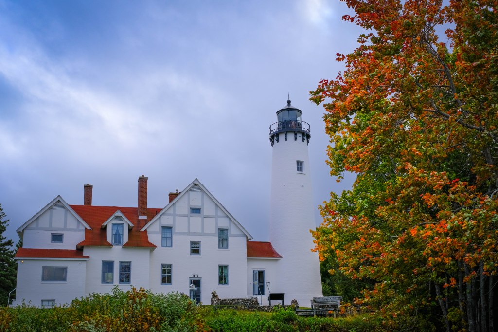
Point Iroquois Light is a lighthouse on a Chippewa County bluff in the U.S. state of Michigan. Point Iroquois and its light mark the division line between Whitefish Bay and the western end of the St. Marys River, the connection between Lake Superior and other Great Lakes. The land and lighthouse are now part of the Hiawatha National Forest and the light is a Marine Museum. Restoration efforts are being conducted under the auspices of the Bay Mills/Brimley Historical Research Society, to whom the site is leased.


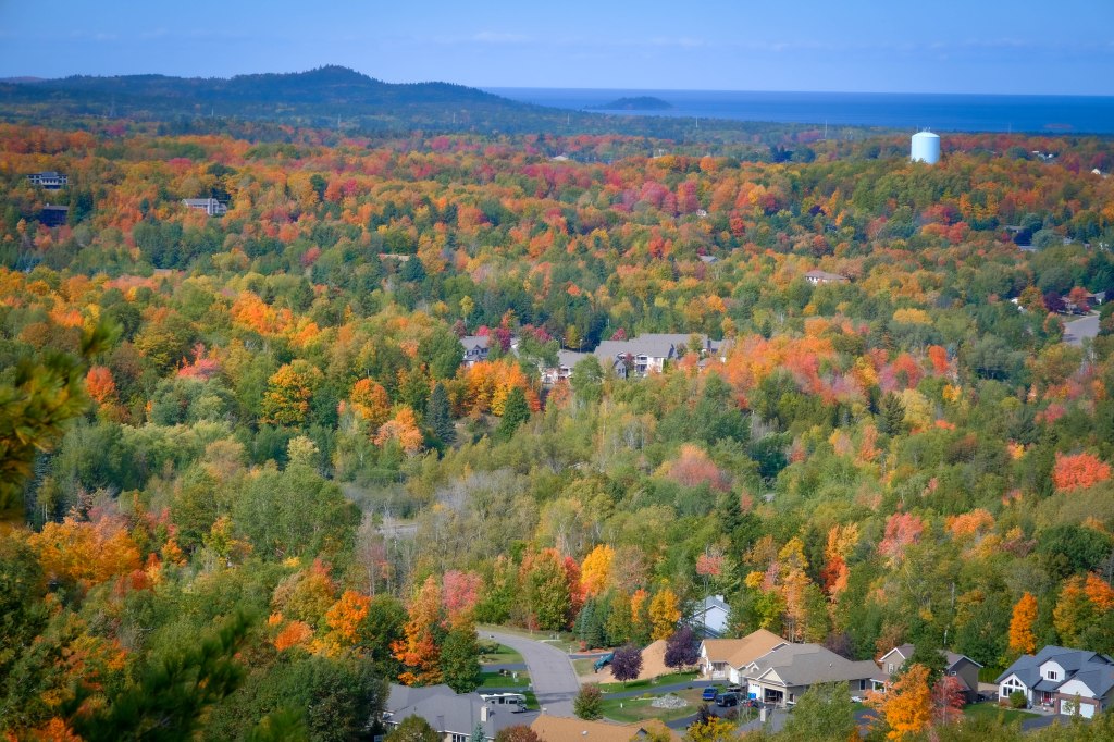
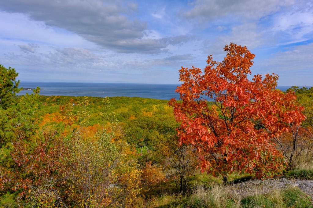
Spectacle Lake can be viewed from a hilltop scenic dirt road. In the distance, you can also see Lake Superior, the Saint Mary’s River, and Canada. On some days, you may see the Sault Sainte Marie bridge or freight ships using the Soo Locks.


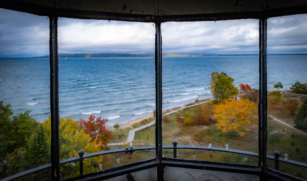
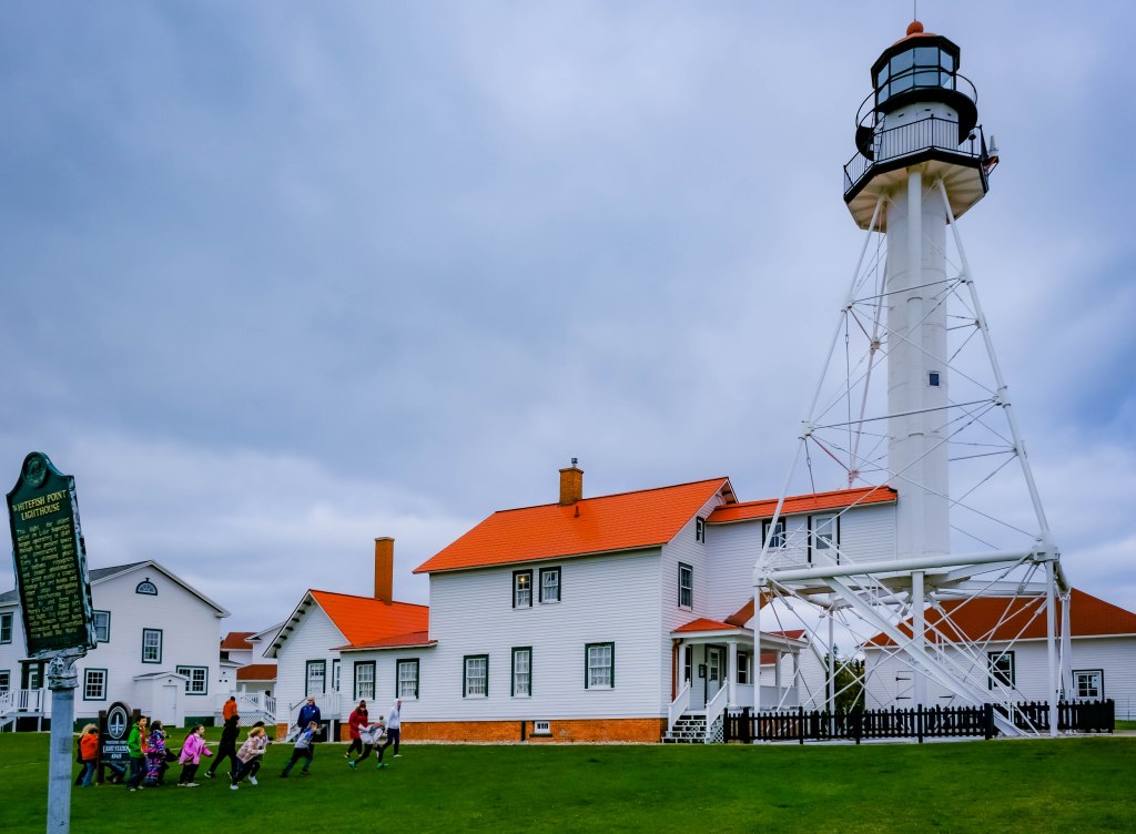
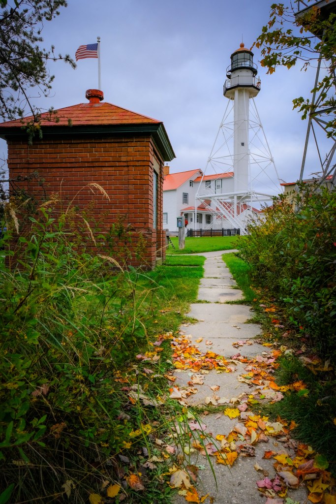
The Whitefish Point Light is a lighthouse located in Chippewa County in the U.S. state of Michigan.[11] Located on the southeastern shores of Lake Superior, it sits at the edge of Whitefish Point leading to Whitefish Bay. Constructed in 1849, it is the oldest operating lighthouse in the Upper Peninsula. All vessels entering or exiting Lake Superior pass near Whitefish Point. The area is infamously known as the “Graveyard of the Great Lakes” due to the high number of shipwrecks in the area, most famously the SS Edmund Fitzgerald.[12] The lighthouse is part of the Great Lakes Shipwreck Museum complex, which contains numerous relics from shipwrecks of the Whitefish Point Underwater Preserve, including the bell of the SS Edmund Fitzgerald. There was a field trip for elementary school students going on while I was there.

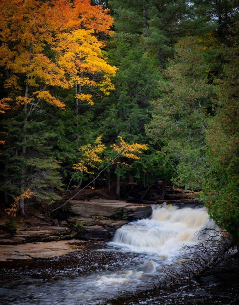
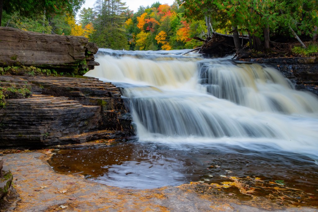
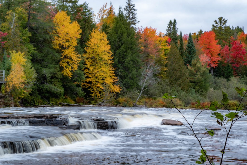
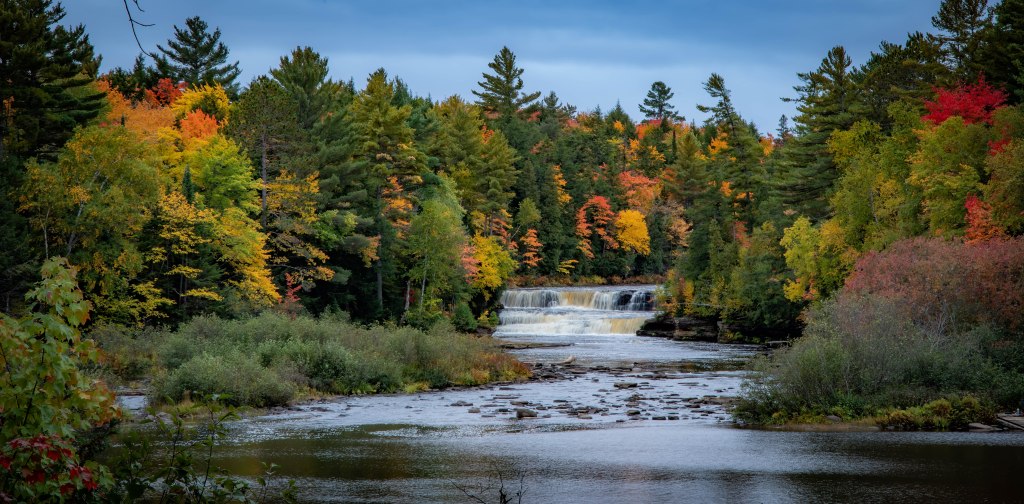
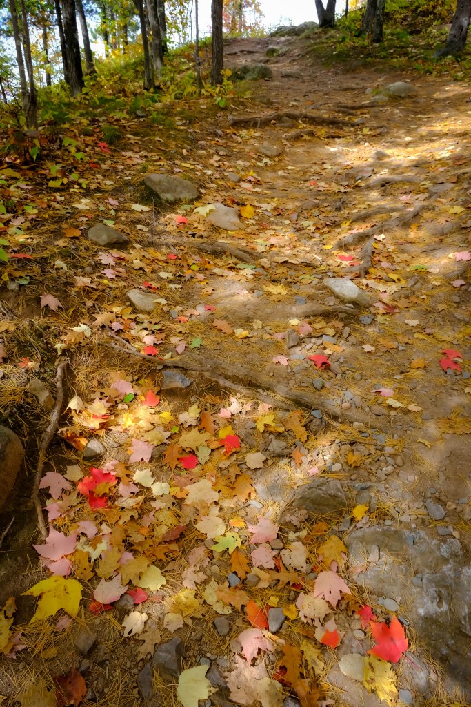
The Tahquamenon Falls are a series of waterfalls on the Tahquamenon River, shortly before it empties into Lake Superior, in the northeastern Upper Peninsula of Michigan. They are the largest waterfalls in Michigan, and one of the largest in the eastern half of North America. The water is noticeably brown in color from the tannins leached from the cedarswamps which the river drains, leading to the nickname “Root Beer Falls”.[2]The falls are within Tahquamenon Falls State Park, between the towns of Newberry and Paradise, and are a popular tourist destination during all seasons.The falls are divided into the Upper and Lower Falls. I hiked the lower falls trail including the new bridge to the island in the middle of the river.


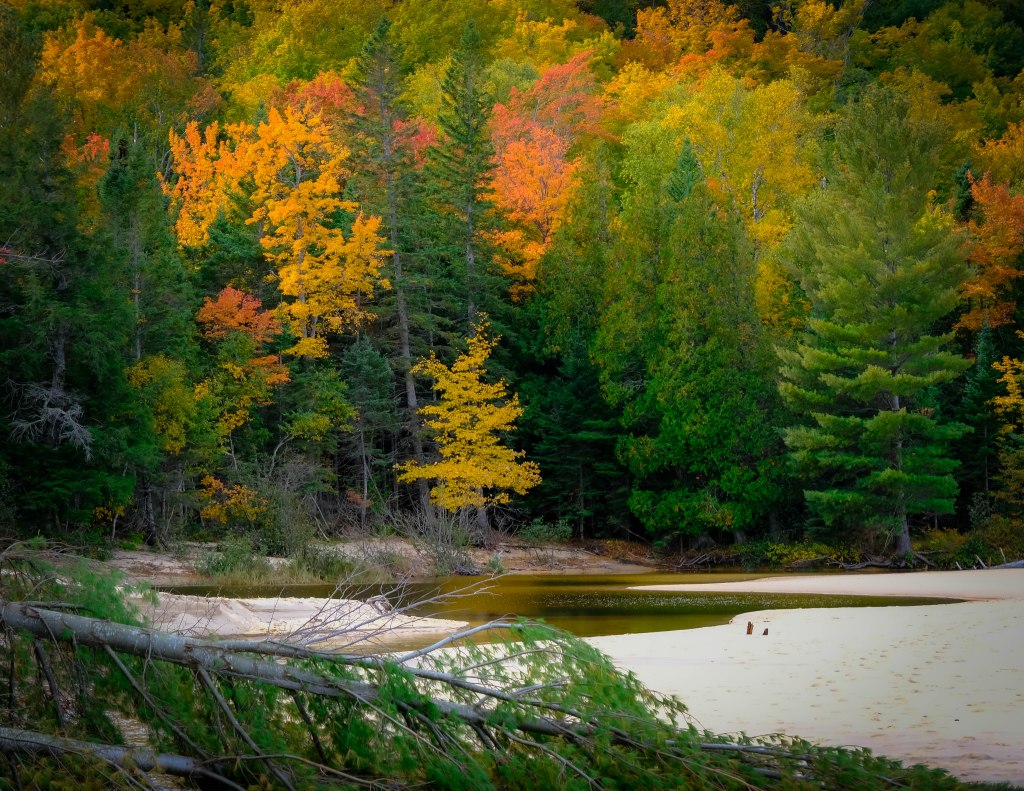
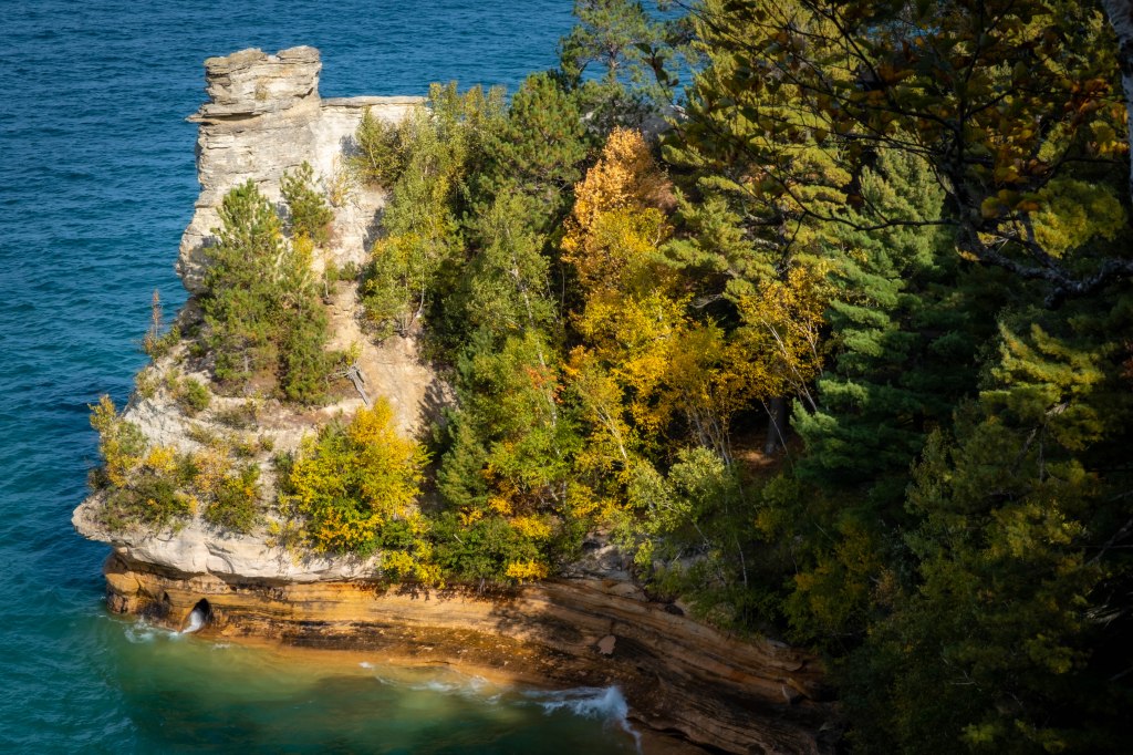
Pictured Rocks National Lakeshore is a U.S. National Lakeshore in the Upper Peninsula of Michigan, United States. It extends for 42 miles (67 km) along the shore of Lake Superior and covers 73,236 acres (114 sq mi; 296 km2). The park has extensive views of the hilly shoreline between Munising and Grand Marais in Alger County, with picturesque rock formations, waterfalls, and sand dunes. Pictured Rocks derives its name from the 15 miles (24 km) of colorful sandstone cliffs northeast of Munising. The cliffs reach up to 200 feet (60 m) above lake level. They have been naturally sculptured into a variety of shallow caves, arches, and formations resembling castle turrets and human profiles. Near Munising, visitors can also visit Grand Island, most of which are included in the separate Grand Island National Recreation Area. The U.S. Congress designated Pictured Rocks the first National Lakeshore in the United States in 1966. Miners Beach is a mile-long stretch of sand with access to Miners River. A boardwalk passes through a jack pine forest on the way to the beach.


Marquette Mountain is a small mountain and ski resort in Marquette, Michigan, the major city in the state’s Upper Peninsula. The hill has a summit elevation of 1,257 ft (383 m) above sea level, over 300 acres and a vertical drop of 457 ft (139 m). The recipient of lake effect snow from nearby Lake Superior, Marquette Mountain Resort receives an average of 150 in (380 cm) of snowfall annually.

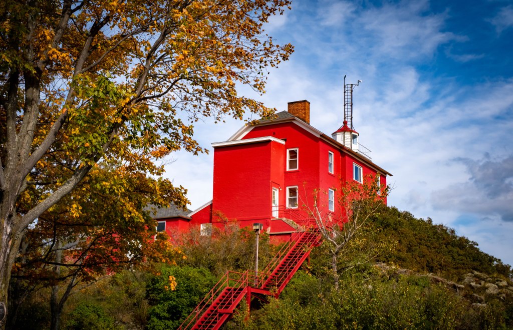
To help navigation towards ore docks, Congress approved funds to build the Marquette Harbor Light in 1850.[12] Construction took place in 1852, and first lit in June 1853. However, the initial structure deteriorated rapidly, and funds were approved in 1865 for a replacement tower.[13] In 1875, the Army Corps of Engineers built a 2,000-foot (610 m) breakwater to reduce the force of wind and waves in Marquette Harbor. A strong storm destroyed the original light in 1889. The new light sits on a concrete crib at the southernmost end of the breakwater wall.[11]In 1853, the United States Lighthouse Board was created and a major system upgrade brought on an installation of a Sixth Order French Fresnel lens in 1856. The new lens was visible up to 10 nautical miles (19 km; 12 mi). Because of weather conditions, installation, maintenance and operation of a foghorn was integral to the operation.[13]

Baraga State Forest, Baraga State Park, Twin Lakes State Park


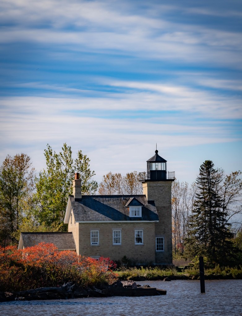
The Ontonagon Light is a lighthouse located off M-64 near Ontonagon, Michigan. It was listed on the National Register of Historic Places in 1975[2] and designated a Michigan State Historic Site in 1973.[3]
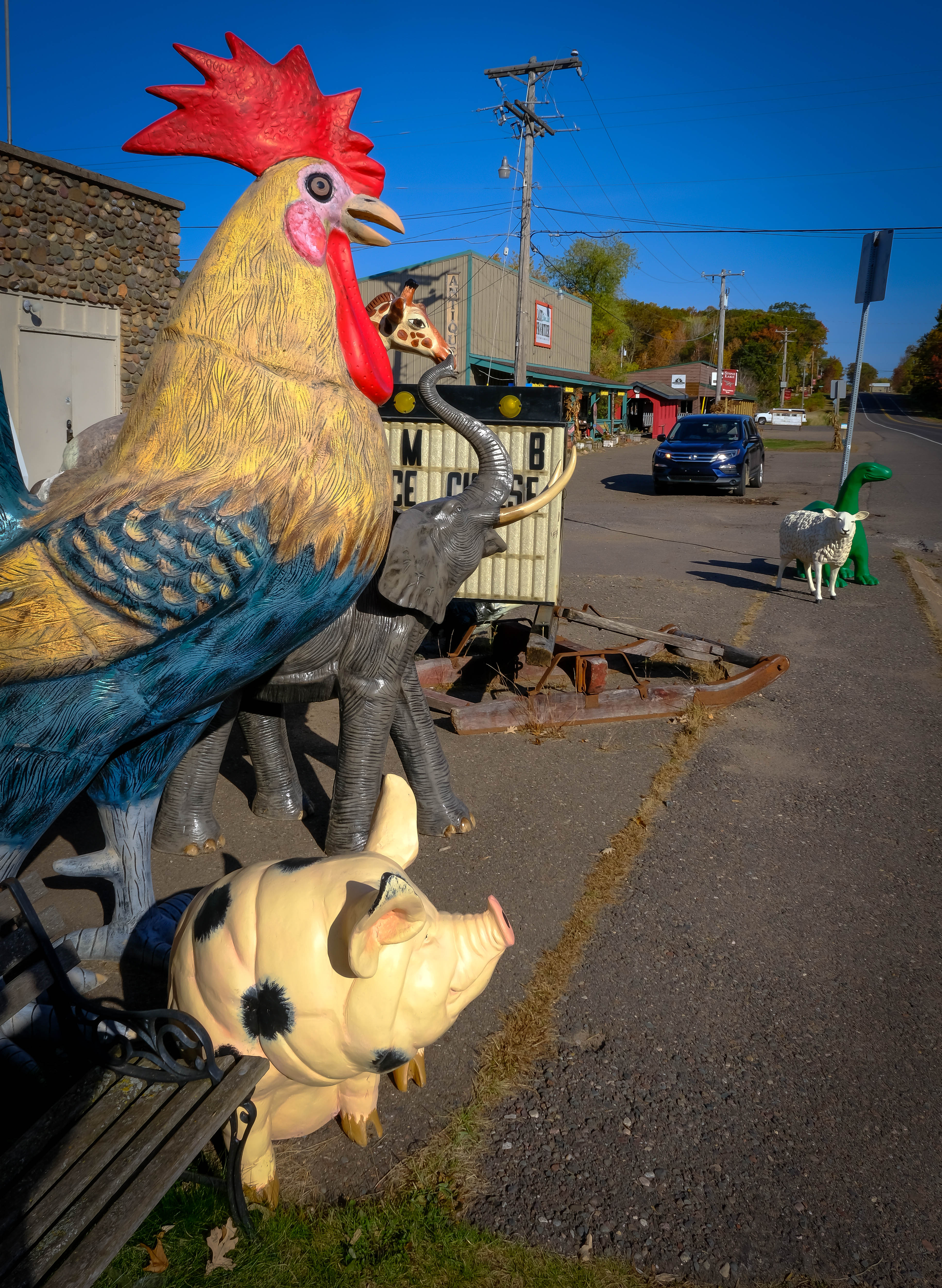
Other Lake Superior Sights


Beautiful photos!
LikeLiked by 1 person